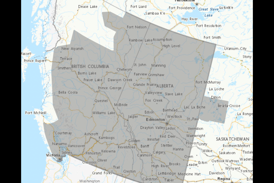
BOW VALLEY – Environment and Climate Change Canada says conditions are favourable today for the development of funnel clouds in the Kananaskis and Canmore area, and warmer than average conditions are expected for the weekend.
The national weather service issued an advisory at noon for the potential of funnel clouds to develop. The advisory area includes much of southern Alberta, including Cochrane, Airdrie, Olds and Sundre.
"These types of funnel clouds are generated by weak rotation under rapidly growing clouds or weak thunderstorms," read the advisory. "This weak rotation is normally not a danger near the ground."
However, there is a chance the rotation could intensify and "become a weak landspout tornado."
Environment Canada meteorologist Sara Hoffman said there is a common misconception that these types of weather events don't happen in mountainous terrain, but a tornado of any magnitude is possible anywhere.
"That being said, one of the important ingredients that goes into making a thunderstorm and then a strong tornado is a trigger," she said. "Often the trigger for these storms is the foothills or eastern slopes of the Rocky Mountains. For that reason, the really, really strong thunderstorms, we don't often see them in the Rockies.
"But that's not to say it's not possible over the year."
The weather service is also calling for unseasonably hot, dry conditions throughout much of the province, particularly in central and northern Alberta, beginning this weekend. The highest temperatures for Canmore and Kananaskis – also included in the weather advisory – are expected from Sunday (May 14) to Tuesday (May 16).
"Daytime highs are expected to be in the high 20s and low 30s," reads the special weather statement. "Overnight and early morning lows are expected to be in the low teens."
Expected daytime highs will be 10 to 15 Celsius above seasonal averages.
"Normal for this time of year is a daytime high of around 14 C for Canmore," said Hoffman.
The incoming weather system, she explained, is a ridge of high pressure aloft which will bring much warmer than normal conditions to British Columbia and Alberta.
Hoffman said the forecasted heatwave is a concern for meteorologists tracking it and for firefighters battling wildfire blazes throughout the province.
"This weekend and into early next week, we're expecting extreme fire danger across most of Alberta," she said. "I can't speak to the specifics of the fires, but what I would say is the risk is really going to increase. We're going to have very dry and hot conditions."
Hoffman said it's critical for people to avoid behaviour that could easily spark a fire in these conditions, like flicking a cigarette butt on the ground.
"Something as easy as that can start a devastating fire that could ruin lives, burn down homes and uproot families," she said. "Be really responsible about how you're behaving and think 'do I really need to have a fire this weekend? Can I dispose this cigarette more safely? Can I make sure that it's out?'
"Think about these things, because the last thing we need is human-caused fires."
Environment Canada encourages people to monitor alerts and forecasts issued. To report severe weather, send an email to [email protected].


