
BANFF – From warm spring temperatures over the weekend to a snowfall warning, residents of Banff, Lake Louise, Canmore and Kananaskis Country are in for another dose of winter this week.
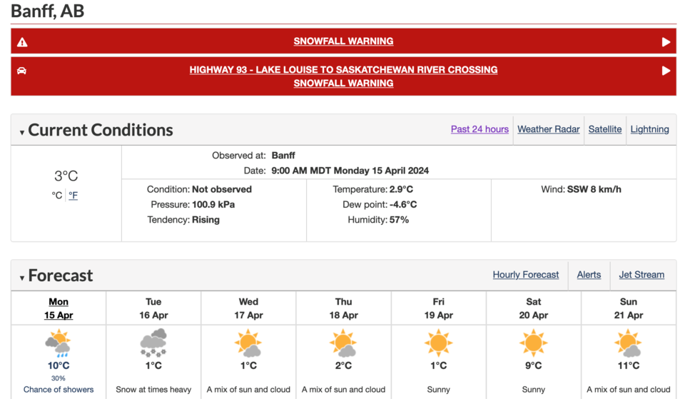
Environment Canada warns of a long period of snowfall beginning Monday evening (April 15), which is expected to dump 10 to 20 centimetres across the region.
Alysa Pederson, a meteorologist with Environment Canada, said heavy snow will begin this evening and taper off by Wednesday (April 17) morning.
She said the system will likely begin as rain in the Canmore and Banff region later Monday afternoon with temperatures still above zero before transitioning to snow tonight.
“The system starts to intensify, it's moving down from the north so it’s kind of coming from that Nordegg, Jasper area, intensifying across Banff, Canmore, including Lake Louise,” she said.
“If anybody is travelling the next couple days from Calgary to the Rockies to that Canmore area, Highway 1 west of Calgary might be a little bit snowy and a little bit hard to drive on at times.”
Anywhere from 10 to 20 cm is expected throughout the mountains, but Pederson said that will vary based on the area and it will be “wet, heavy snow.”.
“Areas in the higher terrain, like Highway 93 is probably going to get closer to that 20 cm and then you have the Highwood Pass down in Kananaskis, they might get a little bit more because they’re a little bit higher.”
The snowfall warning, which also applies to Highway 93 North between Lake Louise and Saskatchewan River Crossing, comes on the heels of a beautiful spring weekend in the mountains, with the mercury in Banff reaching 16.1 Celsius on Sunday (April 14).
Peterson said no temperature records were broken in this region, though, with the record for April 14 sitting at 23 C set in 1988.
“Banff hit 16.1 C yesterday, which is a gorgeous, gorgeous April day, but when we actually look at the records for the area, generally around now the records are sitting in the low 20s,” she said.
“It was a beautiful day. The sun was mostly out and it probably felt pretty good on the slopes and on the patios, but no records.”
Environment Canada warns drivers to prepare for quickly changing and deteriorating travel conditions as the snow arrives.
Drivers are asked to monitor alerts and forecasts issued by Environment Canada.
To report severe weather, send an email to [email protected] or tweet reports using #ABStorm.


