
KOOTENAY – Two more emergency satellite phones are now installed and fully operational through a cell coverage dead zone in Kootenay National Park.
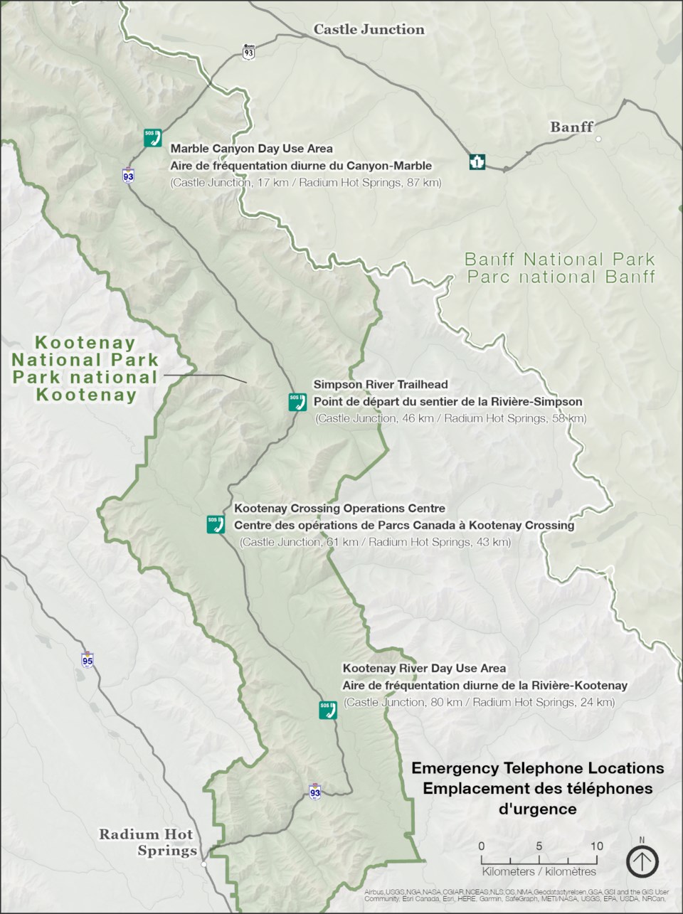
The new satellite phones are located at Simpson River trailhead and Kootenay River day-use area, adding to two others located at Marble Canyon day-use area and Parks Canada’s operations centre at Kootenay Crossing.
Rick Kubian, superintendent for Lake Louise, Yoho and Kootenay field unit, said the phones were put in place because there is currently no cell coverage or WiFi along most of the 105-kilometre stretch of Highway 93 South between Castle Mountain and Radium Hot Springs.
“These four locations are really strategically located and provide emergency phone access that will connect people through to 911 in an emergency,” he said.
“What we hope now is there is an option to call out that should result in a quicker emergency response.”
The emergency phones are a joint $80,000 project between Parks Canada and the B.C. Ministry of Transportation and Infrastructure.
The project, in large part, was motivated by British Columbia’s major twinning construction project on the Trans-Canada Highway in Kicking Horse Canyon near Golden, which requires diverting traffic through Kootenay National Park.
This fourth and final stage includes twinning the remaining final 4.8-kilometres, and has resulted in short-term stoppages to lengthy closures that involve diverting traffic at Golden via Radium Hot Springs and along Highway 93 South to Banff and vice-versa.
As a tourist and commercial transportation corridor, the Trans-Canada Highway near Golden carries more than 10,000 vehicles daily during the summer, with up to 30 per cent of the traffic consisting of commercial vehicles, depending on the time of year.
When the closure is in place for highway construction, that traffic is diverted through Kootenay National Park. Pre-construction, Parks Canada estimated there’s an average of 2,500 vehicles a day on Highway 93 South.
There have been several major accidents this winter. It’s hoped the satellite communication system will lead to better response times from emergency services, given that quicker response times can prove critical to a patient’s outcome.
In November, a major winter snowstorm that dumped between 30 and 60 centimetres of snow in that region shut down Highway 93 South through Kootenay National Park and forced some drivers to spend the night in their vehicles.
Several vehicles lost control during white-out conditions on icy sections of the mountain road, including a semi-trailer that jack-knifed and blocked the two-lane highway during the height of the three-day storm.
While the new emergency satellite phones are welcomed and improve ways to report accidents, Kubian said the region is still a long way from emergency services and drivers need to drive safely and be prepared.
“It’s still a relatively remote stretch of highway that requires appropriate motorist behaviour,” said Kubian.
“Obeying posted speed limits, reducing speed and adjusting speed to the road conditions is really so crucial. I think most motorists understand that, but we have to continue to emphasize that.”
The B.C. government contributed about $40,000 toward the purchase and installation of the emergency phones and Parks Canada is responsible for covering the remaining purchase and installation costs, as well as operational costs and maintenance of the emergency telephones.


